
Environment
Where We Will Feel Climate Change The Most
Where We Will Feel Climate Change The Most
Finding the areas where we will feel climate change the most is a bit of a grey area. Do you test plant reactivity, extreme weather like storms and drought, sea-level rise, urban heat islands or changes to average temperature? Turns out, scientists have used all of these options.
A study published in Nature took a look at ecosystem sensitivity to climate change throughout the past fourteen years, using a measure they call the “vegetation sensitivity index.” The map scientists came up with goes from lower levels of sensitivity shown in green, midlevel in yellow and high level in red. As one would expect, the map has lots of green in areas with little vegetation and hearty plants like east Australia, the American Southwest and the middle of Africa. Lush areas like Rainforest regions and the middle of Canada are spotted in red. Europe and Asia have a string of red that forms a very loose line across the regions. A lot of the map is yellow.
The Weather Channel took a more predictive approach and assessed large cities across the United States. They looked at cities that had a population of more than 200,000 people and then added climate change threats like sea-level rise. They then ranked the cities on a scale from 1-25, 1 meaning the city is most at risk for climate change issues.
To find the most at-risk communities, they started by pulling data from the World Bank that projected future flood losses. They looked at extreme precipitation records in the National Climate Assessment. To assess drought conditions, they pulled a report that was made by Texas Tech University and published in the journal Climate Dynamics, which projected springtime drought down the line. They looked at urban heat islands, the phenomenon where a city is warmer than nearby rural areas. The information came from Climate Central, a nonprofit scientific organization focusing on climate change. Finally, they pulled data projecting precipitation and temperature changes from the National Climate Assessment.
The results weighed in as such:
- New Orleans: noted for the 1,900 square miles it has lost in the last century from rising sea levels.
- Minneapolis: has a 40% increase in precipitation since 1958 and has some steep urban heat island trends.
- Las Vegas: has scorching temperatures that are already on the rise, and is an urban heat boiler. Has issues with increasing drought.
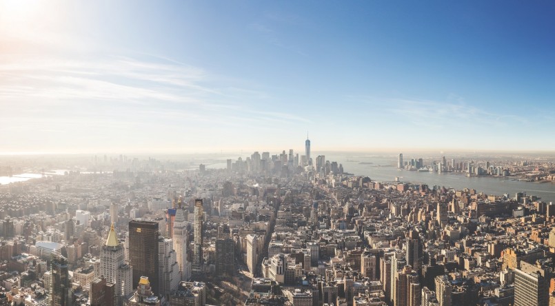
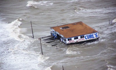
- New York: between the rising sea levels and super storms like Hurricane Sandy, New York is far from safe.
- Kansas City, Mo.: this area is being hit by drought, flooding from increased precipitation and urban heat zones.
From there, large cities all across the United States are ranked, from Newark, N.J., at 25, to Seattle, at 20. Maybe the greatest lesson to take away from all of this is that climate change won’t affect just coastal regions or places that are already having drought issues, as it’s easy to assume. It’s a truly global issue.


0 comments